A 662-mile blizzard will hit the UK within weeks from London to the tip of Scotland in Thurso, according to weather forecasts. Maps by WXCharts predicted the snow will hit northern UK on February 1, and by February 3, large parts of southern England could be buried under snow too, with 22 cities impacted across Britain.
According to its winter overview, a band of rain will move across the Channel on the morning of February 3, falling as snow in some areas as temperatures plummet to below freezing. Then, by midnight, the rain will have moved off towards the North Sea and cleared from the Channel, leaving behind a huge band of snow that will continue to fall overnight into February 4.
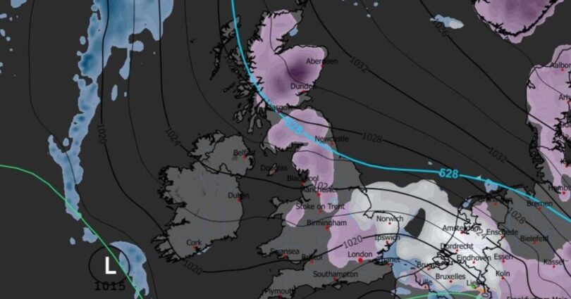
In Scotland, a staggering 91cm of snow has been forecast at the border of Aberdeenshire and Perthshire, where it could drop to -5C, with heavy precipitation forecast over the centre of the country.
In England, Northumberland could be hit with up to 7cm of powder, and Cumbria could receive 11cm of snow on the coast. With the north forecast lows of -4C at 6am on February 3, this combination could create icy conditions on the roads.
Up to 8cm of snow has been forecast in Norfolk and Suffolk, which could continue well into the night. Snowfall over the Midlands varies between 1cm and 4cm.
North Yorkshire and East Yorkshire could remain dry, as could the south coast of England, according to the maps. Wales has been forecast a light shower of snow in the north, while Northern Ireland looks set to escape the extreme weather.
The Met Office acknowledges that forecasting snow is difficult. Its long-range forecast from January 25 until February 3 predicted that mild conditions were likely to turn « somewhat colder » and bring the risk of some snow showers, which it said were most likely across hills in Scotland and northern England.
Source link